This is AI generated summarization, which may have errors. For context, always refer to the full article.
Aside from the northern portion of Catanduanes, more areas on the eastern side of the Philippines are placed under Signal No. 1 at 11 pm on Wednesday, October 1
MANILA, Philippines – More areas were placed under Signal No. 1 due to Tropical Depression Paolo on Wednesday evening, October 1.
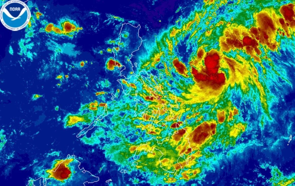
As of 10 pm on Wednesday, Paolo was located 565 kilometers east of Virac, Catanduanes, or 695 kilometers east of Daet, Camarines Norte.
The tropical depression slightly slowed down, moving west at 20 kilometers per hour from 25 km/h.
It continues to have maximum sustained winds of 55 km/h and gustiness of up to 70 km/h.
But the Philippine Atmospheric, Geophysical, and Astronomical Services Administration (PAGASA) sees Paolo strengthening into a tropical storm on Thursday, October 2, and into a severe tropical storm by early Friday morning, October 3. Typhoon status is not ruled out as well.
Paolo could make landfall in Isabela or Aurora on Friday morning or afternoon. But its track might shift further southward or downward, “depending on the strength of the high pressure area” above it.

The following areas are under Signal No. 1 as of 11 pm on Wednesday, which means they will see strong winds from Paolo:
- eastern and central parts of Isabela (Alicia, San Mateo, Aurora, San Mariano, Ramon, Naguilian, Dinapigue, Roxas, San Guillermo, Luna, Cauayan City, Echague, Ilagan City, Angadanan, Benito Soliven, Santiago City, Reina Mercedes, San Agustin, San Manuel, Palanan, Cabatuan, Quirino, Gamu, San Isidro, Cordon, Jones, Burgos, Maconacon, Divilacan, Tumauini)
- Quirino
- northern and central parts of Aurora (Dilasag, Casiguran, Dinalungan, Dipaculao, Baler, Maria Aurora, San Luis)
- northern part of Catanduanes (Pandan, Bagamanoc, Panganiban, Viga)
If Paolo eventually becomes a typhoon, Signal No. 4 would be the highest possible tropical cyclone wind signal.
Meanwhile, these provinces are still likely to receive the most rainfall:
Thursday evening, October 2, to Friday evening, October 3
- Heavy to intense rain (100-200 millimeters): Cagayan, Isabela, Quirino, Aurora, Apayao, Abra, Benguet, Kalinga, Mountain Province, Ifugao, Nueva Vizcaya
- Moderate to heavy rain (50-100 mm): Ilocos Norte, Ilocos Sur, La Union, Pangasinan, Nueva Ecija, Tarlac, Zambales, Bataan
Friday evening, October 3, to Saturday evening, October 4
- Heavy to intense rain (100-200 mm): Ilocos Sur, La Union
- Moderate to heavy rain (50-100 mm): Ilocos Norte, Apayao, Abra, Mountain Province, Benguet, Kalinga, Pangasinan, Ifugao
There is also a moderate risk of “life-threatening” storm surges with peak heights reaching 1 to 2 meters in Cagayan, Isabela, Aurora, and Quezon within 48 hours.
For the seaboards of Northern Luzon and Central Luzon, rough to very rough waters are expected during the passage of the tropical cyclone.
ALSO ON RAPPLER
Paolo could leave the Philippine Area of Responsibility (PAR) by Saturday morning, October 4.
Paolo is the country’s 16th tropical cyclone for 2025, and the first for October. During the month, two to four tropical cyclones are estimated to form within or enter PAR. – Rappler.com


